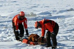
Minot, North Dakota, June 23, 2011 The flood waters threaten to spill over the temporary dikes.
Middle America is still recovering from the damages from spring flooding. But the battle isn’t over yet. America, get prepared what may be the worst in decades.The National Weather Service predicts more rain over the next two weeks in the Midwest and northern Plains regions, the areas already damages by the overflow of Mississippi and Missouri rivers. Experts warn this summer’s flooding may rival the Great Flood of 1993, which lasted over four months and caused $25 billion in damages.
(PHOTOS: Historic Floods in North Dakota)
“The sponge is fully saturated – there is nowhere for any additional water to go,” Jack Hayes, director of the National Weather Service said.
Due to earlier rain, even small precipitation can trigger the already high rivers to run over to the soil that is completely soaked with no room to absorb more. What’s worse, the hot weather may double the threat. The Rockies saw unusually heavy snow storms that lasted later than normal years. Snow piled up in the mountains can melt in the heat and stream down the Rockies.
The National Weather Service expects heavy rainfall over the next couple of weeks which, at worst, can last up to three months.
(GRAPHIC: Storm Tracker)
Here are NOAA safety guidelines in preparation for the epic rainfall.
The highest flood risk areas include:
- North Central United States including the upper Missouri River and Souris River (western North Dakota) and Red River of the North (border of North Dakota and Minnesota), Minnesota River (Minnesota), Upper Mississippi River (Minnesota and Iowa), and Des Moines River (Iowa)
- Lower Missouri River from Gavin’s Point (Nebraska and South Dakota border) downstream along the border of Nebraska and Iowa, continuing along the borders of Kansas and Missouri then through Missouri to the Mississippi River
- Tributaries to the Lower Missouri including the James and Big Sioux Rivers in North Dakota
- Lower Ohio River Valley including the White, Wabash and lower Ohio River
- East of Rockies: North Platte River in Colorado, Wyoming and Nebraska and Yellowstone River in Wyoming and Montana
- West of Rockies: Utah and Colorado
NOAA offers the following flood safety tips:
- Determine whether your community is in a flood-risk area and continue monitoring local flood conditions at http://water.weather.gov.
- Visit http://www.ready.gov for flood preparedness advice to safeguard your family, home and possessions and for more information about the National Flood Insurance Program.
- Purchase a NOAA Weather Radio receiver with battery power option to stay apprised of quickly changing weather information.
- Study evacuation routes in advance and heed evacuation orders.
- Turn Around, Don’t Drown – never cross flooded roads, no matter how well you know the area or how shallow you believe the water to be.


